Bali
Kelingking Beach
Visit Kelingking Beach with current guidance on access, steep-trail risks, beach conditions, construction, and cliff safety.
Quick Facts
- Location
- Bunga Mekar, Nusa Penida, Klungkung
- Suggested duration
- 45–90 minutes for viewpoint; much longer for descent
- Best time
- Early morning for lower crowd pressure
- Beach descent
- Very steep and hazardous; current access must be checked
- Swimming
- Not recommended without current local safety clearance
- Construction/access status
- Requires live verification due to recent development and enforcement changes
Location on Google Maps
Klungkung, Bali
Travel Advisor Score
One of Nusa Penida’s most distinctive coastal views.
Iconic elevated composition.
Viewpoint visit possible with close supervision.
Uneven terrain, crowding, and steep exposure.
Descent and surf conditions carry serious risk.
Peak day-tour hours can be extremely busy.
Best For
- ✓ Cliff scenery
- ✓ Photography
- ✓ Short Nusa Penida visits
- ✓ Viewpoint-focused visitors
Reconsider If
- Plan to swim without local safety clearance
- Fear heights
- Limited mobility
- Ignore barriers or construction status
Overview — English
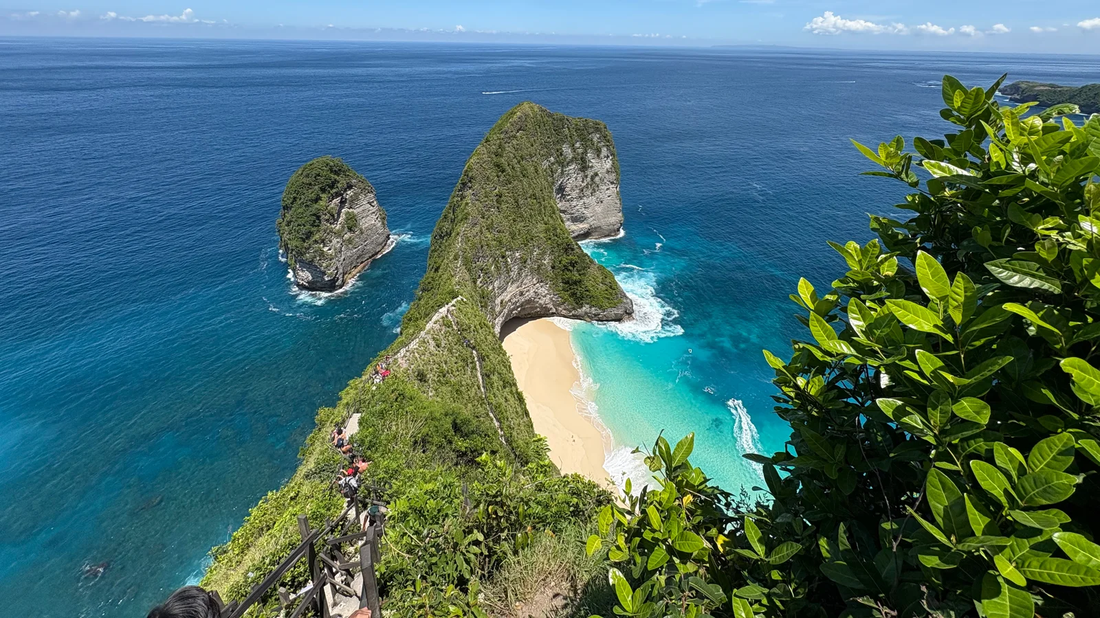
Kelingking Beach is best understood as a viewpoint destination rather than a conventional swimming beach. From the cliff top, visitors see the rock formation often compared to a dinosaur silhouette and the sandy cove far below.
The route to the beach is extremely steep, exposed, and historically hazardous. Waves and currents can change quickly, while evacuation from the lower area is difficult. Visitors should not descend simply because others are doing so, and should not enter the water without clear current local safety guidance.
Construction status, restrictions, and access arrangements around Kelingking have changed in recent years. Current conditions must be verified directly before publication and travel. For most visitors, enjoying the view from a safe upper area is the most responsible choice.
Travel Tips
- 1.Visit early to reduce crowd pressure.
- 2.Stay behind barriers and avoid exposed photo positions.
- 3.Treat the descent as a serious hike, not a casual staircase.
- 4.Do not swim without explicit current local safety clearance.
Accessibility
Confirm current terrain, surfaces, stairs, drop-off points, and local assistance.
Do not publish a definitive claim without current field verification.
Facilities
- Parking or drop-offAvailable
Current arrangement requires verification.
- ToiletsAvailable
Availability and accessibility vary.
- Food and drinkAvailable
Availability varies by access point and operating conditions.
Ticket Information
| Category | Price | Notes |
|---|---|---|
| Current admission | See Quick Facts | Verify directly before publishing and traveling. |
Last verified: 2026-07-17
Opening Hours
See Quick Facts
Recheck official or on-site information.
Last verified: 2026-07-17
Nearby Destinations
FAQ — English
How much time should I allow?
45–90 minutes for viewpoint; much longer for descent. Adjust for weather, road conditions, and crowd levels.
Is operational information final?
No. Tickets, access, weather, restrictions, boat schedules, and safety rules must be rechecked through official sources or local staff.
What are the main risks?
Risks vary by destination but may include waves, cliffs, slippery paths, steep terrain, weather, and operator standards.
Sources
- Klungkung Regency tourism and government portal
2026-07-17
- Klungkung Tourism Office — safety signs and barriers inspection
2026-07-17
- Klungkung Tourism Office — Kelingking footpath planning
2026-07-17
- Bali Provincial Tourism Office
2026-07-17
- Indonesia Travel — Nusa Penida context
2026-07-17
- Wikimedia Commons search — Kelingking Beach
2026-07-17